Educating Harlem A Century of Schooling and Resistance in a Black Community
Maps
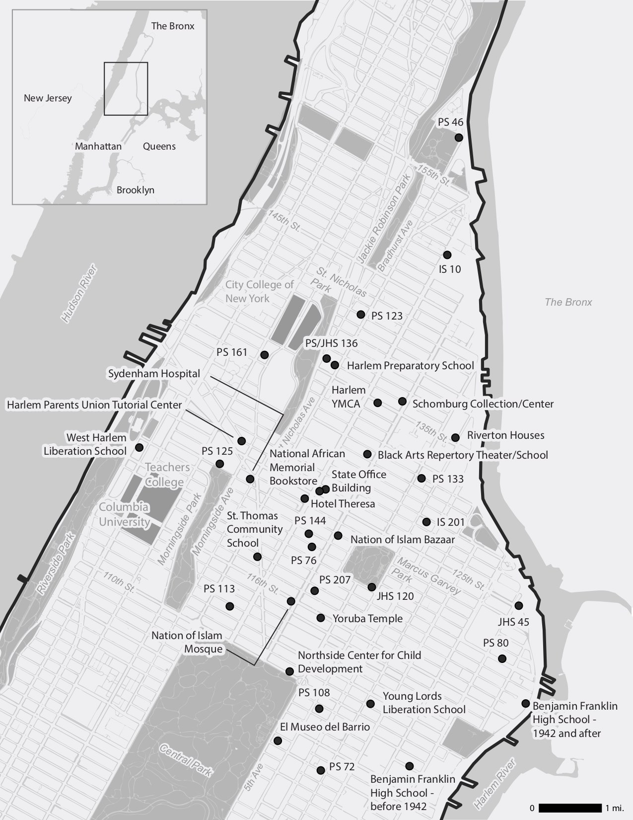
Locations that appear in chapters 1 through 6
Locations that appear in chapters 7 through 13
Please note that these maps to do not offer a comprehensive portrayal of Harlem’s educational landscape. They show those sites that receive substantial discussion in the chapters in this volume.
Map design by Rachael Dottle. Map research by Rachel Klepper. Map layers from: Department of Information Technology and Telecommunications, Department of Urban Planning, City of New York; Atlas of the city of New York, borough of Manhattan. From actual surveys and official plans / by George W. and Walter S. Bromley New York Public Library Map Warper; Manhattan Land book of the City of New York. Desk and Library ed. [1956]; New York Public Library Map Warper; and State of New Jersey GIS. Point locations from: School Directories, New York City Board of Education, New York Amsterdam News via ProQuest Historical Newspapers, and multiple archival sources cited in relevant chapters.